 |
الإدارة في سياق برنامج القاهرة ٢٠٥٠
هويدا كامل - مديرة وحدة القاهرة
في يوم ٢٢ يونيو من هذا العام تحدثت مع الدكتورة سحر عطية Dr. Sahar Attia، الرئيسة الجديدة لقسم الهندسة المعمارية في كلية الهندسة بجامعة القاهرة Department of Architecture at the Faculty of Engineering at Cairo University قدمت الدكتورة سحر نظرة ثاقبة لقضايا التخطيط الحضري في القاهرة الكبرى و الأساليب التي يتم استخدامها لتوفير الخدمات لسكان هذه المنطقة.
حين يتم مناقشة منطقة القاهرة الكبرى، من الشائع أن تتغاضى الناس عشوائيات هذه المنطقة، و تقوم بالتركيز على بعض المواقع الجغرافية التي يصل لها الخدمات الأساسية ويعيش فيها سكان ذات دخل مرتفع أو معقول. سألت الدكتورة سحر عن رأيها بشأن مسألة الشمول الاجتماعي في سياق التخطيط الحضري، و عن تقييمها لشمولية المدينة.
"أرى أن المدينة تنتمي الأن للفقراء أكثر من فئات الشعب الاخرى، أو بمعنى أصح إلى القطاع غير الرسمي، و ذلك لأن المناطق العشوائية ليست كلها فقيرة، بل هي غير مخططة. الفئات ذات الدخل المنخفض تعيش في قلب القاهرة. يغطي الشمول الاجتماعي حاليا الطبقات العليا و الطبقات المتوسطة العليا التي حاولت الهروب من المدينة و الانتقال إلى التجمعات المنعزلة في مدينة ٦ أكتوبر، و القطامية، و الشروق. وقد صممت جميع المستوطنات الجديدة بالقاهرة لإيواء السكان الجدد بدل من سكان العشوائيات المتزايدين داخل المدينة. و لكن العكس حدث: تعيش الآن المجتمعات غير الرسمية في وسط المدينة، بينما تعيش المجموعات المخطط لها في أطراف المدينة. والأن، يجب علينا أن نجد وسيلة مؤثرة لإدماج جميع السكان."
و أوضحت الدكتورة سحر أن أفضل وسيلة لخلق بيئة يعيش فيها الجميع على قدم المساواة هي توفير مرافق متعددة الاستخدامات في منتصف المدينة، وخاصة في وسط البلد.
السكان ذوي الدخل المنخفض يرفضون الرحيل إلى المدن الجديدة بسبب قضايا النقل: هؤلاء الناس يعملون في وسط المدينة، و هناك أيضا تعيش عائلاتهم. وبالتالي، فإن المشكلة الأولى التي حاولت المدينة حلها هي مسألة المواصلات. يسعى مسؤلين المدينة إلى تحسين وسائل النقل من خلال بناء خط مترو جديد بين حي امبابة و مطار القاهرة الدولي.
"نحن بحاجة إلى إدارة الخدمات المقدمة في القاهرة، و رصد و متابعة إستخدام الأراضي. عملية إدارة استخدام الأراضي سوف ترفع مستوى المعيشة و تحسن وسائل النقل. ليس لدينا خطة مبرمة لاستخدام الأراضي للسماح لمخططي المدن بالتحكم في الزحف العمراني."
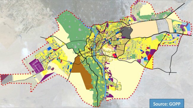
و قد قمنا أيضا بمناقشة آليات التخطيط التي استخدمتها الحكومة في برنامج القاهرة ٢٠٥٠. ومن المثير للاهتمام هو أنه تم ترجمة البرنامج للغة العربية و ربطه بالرؤية الوطنية المصرية لعام ٢٠٥٢ فقط بعد ثورة ٢٥ يناير. فمن المنطقي أن نفترض أن هناك تداخل بين رؤية الخطتين. و القاهرة الكبرى هي عاصمة الدولة و المنطقة الأكثر اكتظاظا بالسكان لدرجة أنها تسمى 'مصر' كثير من الأحيان.
"نرى أن هناك هيئات منفصلة تخلق خطط مماثلة، و لكن هناك نقص في الجهود التعاونية, و لم يتم ربط هذه الخطط أبدا."
"الرؤية الوطنية ليس لديها خطة محددة للقاهرة، و توضح هذه الرؤية أن هناك مناطق عشوائية يجب معالجتها في جميع المدن، بما في ذلك القاهرة. ومع ذلك، فإنها تخلق روابط من خلال معالجة القطاعات الاقتصادية والاجتماعية الكبيرة. لا ترتبط الخطتين تبعا لمكانهم أو موقعهم الجغرافي، بل بحلول المواضيع العامة في جميع أنحاء البلد."
و يشيرعدم التنسيق بين هاتين الخطتين إلى مشكلة سوء الادارة في هيئات التخطيط.
"نحن لا نقدر أهمية الإدارة في مصر. كثير من الأحيان نفرق بين الدول المتقدمة و الدول النامية، و لكنني أود أن أوصفهم كدول مدارة و دول غير مدارة، لأن هذه البلاد المعروفة بالدول النامية لديها الموارد الكافية لتصبح دول متقدمة باستثناء ما يلزم من الإدارة و التوجيه لرفعهم لهذا المستوى."
Management in the context of the Cairo 2050 plan
Howaida Kamel, Cairo Community Manager
On June 22, I spoke with Dr. Sahar Attia, the new Chair of the Department of Architecture at the Faculty of Engineering at Cairo University. Dr. Sahar provided insight into issues of urban planning in Greater Cairo Region (GCR) and the methods used to provide services to Cairenes.
When discussing the GCR, it is often easier to focus on certain geographic locations that are also characterized by income levels and access to services. I asked Dr. Sahar about her view on the issue of social inclusion on an urban planning level, and how she would characterize Cairo's inclusiveness.
I see that the city now belongs more to the poor, or rather more to the informal, because the informal areas aren't all poor, they are unplanned. The low-income groups live in the heart of Cairo. Inclusion now refers to the upper classes or even the upper-middle classes, which have tried to escape the city, and have moved to the gated communities in 6th October, Katameyya, and Shurouk. All of the new settlements within Cairo were designed to house the new populations rather than the growth of the informal areas in the inner city. But the reverse happened: the informal communities now live in the inner city, while the planned groups live on the periphery. And now we need to find a way to incorporate everyone.
Dr. Sahar indicated that the best way to create an environment that is equally accessible for all would be through the provision of mixed-use facilities in the middle of the city, especially downtown.
Lower-income residents refuse to go the new cities because of issues of transportation: they earn their living here, their jobs and their families are in the city. So the first thing that the city has tried to address is the issue of transportation. They are trying to do so with the building of the new metro line between Imamba and the airport.
We need to manage the city in terms of the services offered and designating land-use. The management of land use is what will affect the quality of life and transportation. We don't have an approved land use plan that allows city planners to control urban sprawl.
We also discussed the planning mechanisms used by the government in the Cairo 2050 vision. Interestingly, it was only after the January 25th revolution that the vision was translated to Arabic and linked to the Egyptian national vision for 2052. It seems logical to assume that there would be overlap between the two plans' vision for Cairo. Beyond being the capital, the GCR is the most populous region in Egypt, and even linguistically, Egyptians interchange the term Al Qahera (Cairo) with Masr (Egypt).
They are two different plans created by two separate bodies that were never linked.
The national vision does not have a specific plan for Cairo. It states that in all cities, including Cairo, there are informal areas that must be addressed. However, it creates these linkages by addressing larger economic and social sectors, not specific cities. The two plans aren't connected by geographic location or place, but by the overall themes that connect the issues to the locations.
The fact that these two plans were never originally coordinated also indicates a management issue in the administrative and planning bodies.
We don't understand how important management is. We often refer to countries as developing vs. developed, but I like to refer to them as non-managed countries and managed countries. Because these countries have the resources they need to be "developed," except for the necessary management and guidance that will bring them to that level.